Route at a Glance
- Date: April 12th, 2025
- Trailhead Parking: Marion Mountain Trailhead 33.79108, -116.73559
- Trailhead Amenities: None
- Trail Signage: Yes, but can be hard to follow in spots on Marion Mountain Trail due to spurs | navigation recommended especially in winter conditions
- Difficulty: Strenuous
- Route Type: Out and Back
- Distance: ~12 miles round trip with no snow | shorter with snow due to cutting switchbacks (Today I tracked 10.7 miles with snow)
- Elevation Gain: 4,374 feet
- Wilderness Permit Required: Yes
- Dogs: Not allowed
- Best Time to Hike: May through September
Nestled near the communities of Pine Cove and Idyllwild in Southern California is the hardest hike up to San Jacinto Peak as it is the shortest hike to the peak. On a snow free day, i’ve clocked it at 12.1 miles with 4,537 feet of elevation gain. This trail is primarily on the north aspect of Marion Ridge, so it holds snow late into the season. When that happens, the trail disappears and you could complete this hike under 11 miles from steep and direct ascents. This trail can be busy on the weekends, but nothing in comparison to the other easier trails (Deer Springs, Humber Park, and South Ridge) that you can take to the peak, so parking is not really an issue. You do not need to display an Adventure Pass when parking at the trailhead.
What to expect
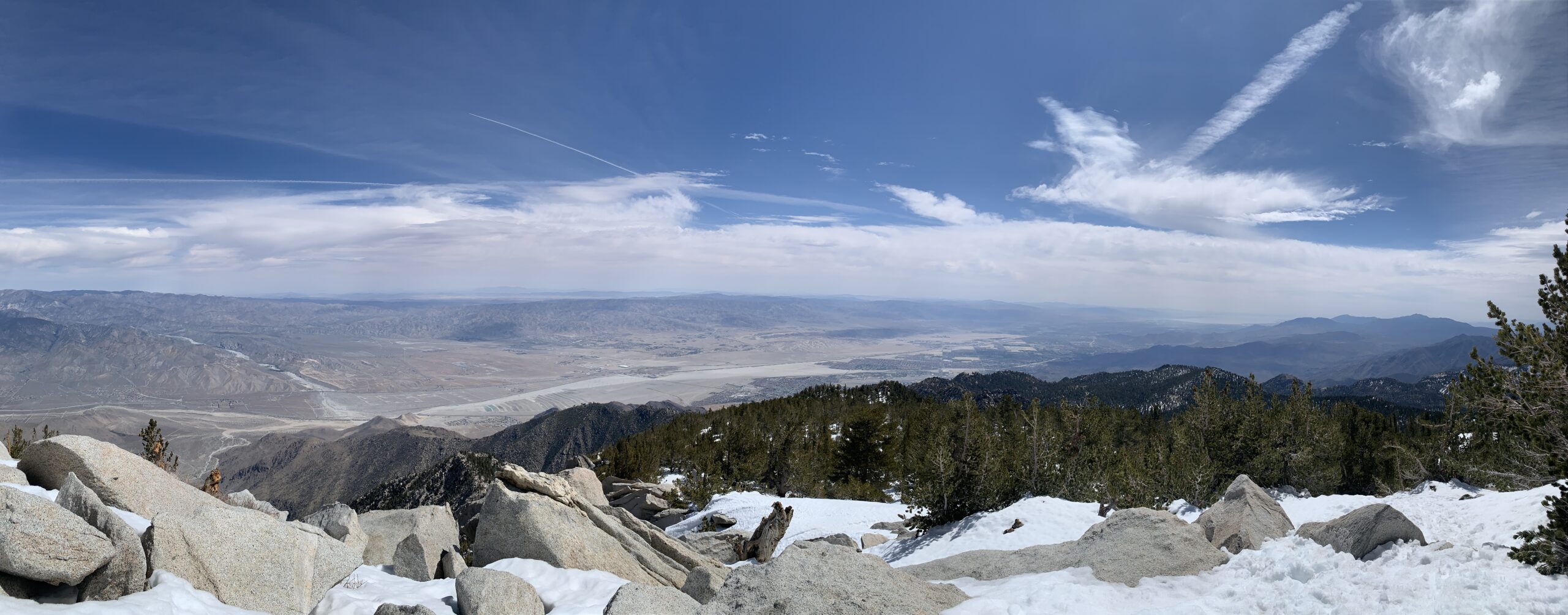
- Views: Spectacular views to the north/northwest from Marion Ridge where you will see Black Mountain and even San Bernardino Peak and San Gorgonio in the distance as you climb | 360 degree views at the peak of the surrounding San Jacinto Mountains and desert landscape, the Coachella Valley and Salton Sea, as well as San Gorgonio peak
- Weather: Check the peak forecast here
- Parking: There is a large dirt parking area at the trailhead, though part of the road is eroded making access a little difficult so most people park their cars along the road | No Adventure Pass is required to be displayed
- Crowds: This trail does see an increase in numbers on weekends, but you can usually always get a parking space | This is the hardest way to ascend to the peak, which deters a lot of visitors
- Camping: The trailhead is right next to Marion Mountain Campground | Reservations need to be made through Recreation.gov
- Water Resources: I wouldn’t rely on any water resources on Marion Mountain Trail as the stream is seasonal and may not be reliable, but the North Fork of the San Jacinto River does flow once you pass the junction with the PCT, but before you veer off the PCT onto Deer Springs Trail (33.80073, -116.69874). Sometimes there is water flowing just before you start to ascend to Little Round Valley Campground and there is also the chance that a stream is running within Little Round Valley Campground. In the summer it is important if you are going to need to filter water to regularly research the flow of water sources along this trail | I usually bring enough water to get my through my day hike, but if you plan on camping at Little Round Valley or plan to filter, you should do more research depending on the season
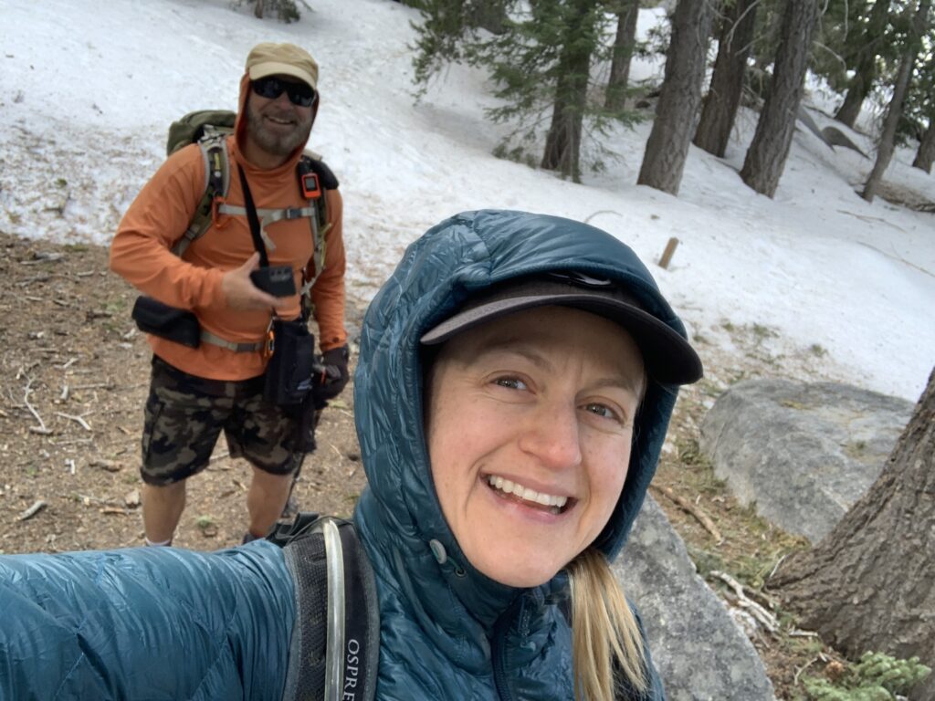
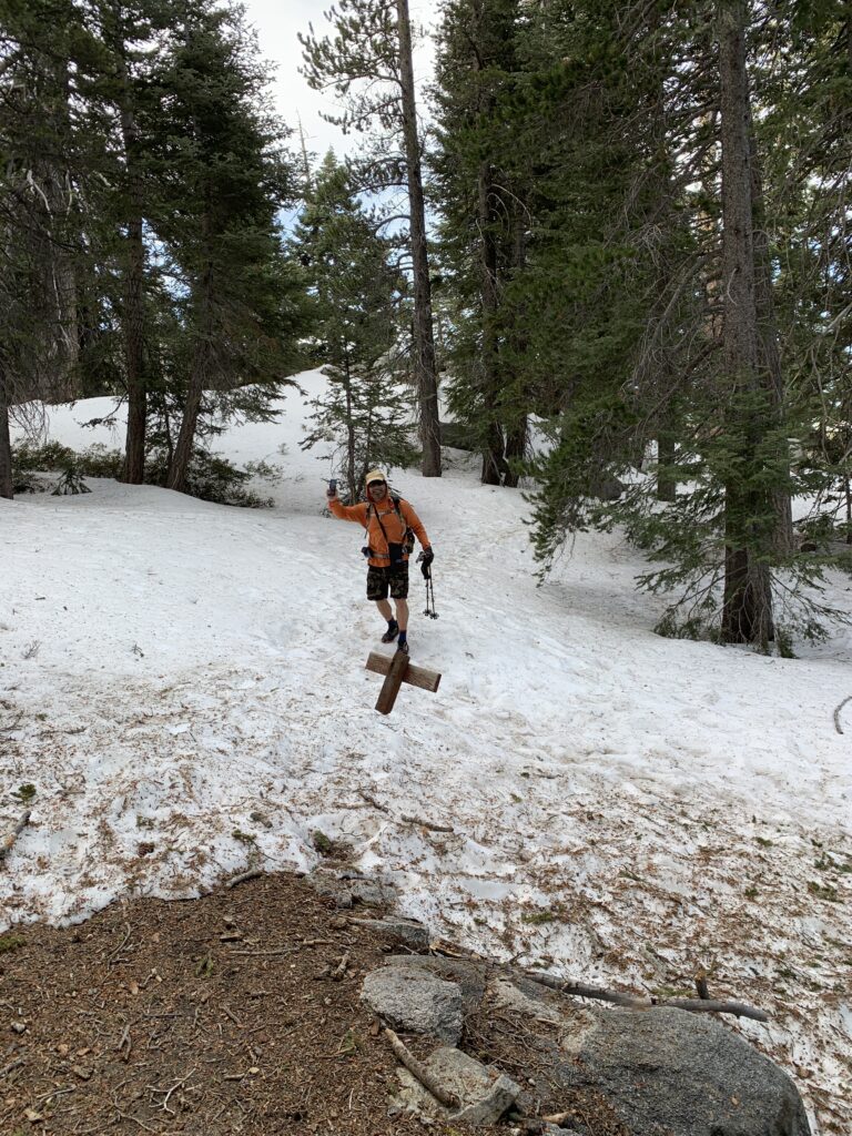
Phil and I had a start time of 6:00am. The trail immediately begins climbing and continues to grow steeper as you progress. About a mile or so in on the trail, we began seeing patches of snow. There were many times we had to re-check our GPS to ensure we were on trail as there were some tree falls and random spurs that branched out to other directions. Just before the PCT junction was where the snow became continuous and the trail nonexistent. The elevation gain here gets more gradual and is a nice break from the 2 1/2 mile or so grueling climb on the Marion Mountain Trail. There was foot traffic packed into the snow that could be followed. The North Fork of the San Jacinto River was flowing well and could be used as a reliable water source before joining the Deer Springs Trail. Trail runners and microspikes were sufficient for the ascent.
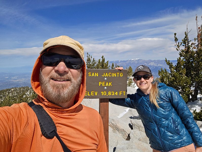
Once we passed through Little Round Valley, it was a straight shot up to the Peak Trail junction. It really was just referencing the GPS and going straight up. There was not much foot traffic at all to follow. The weather was warm and sunny with 20 mph winds at the peak. We hung out and grubbed for about an hour making small talk with PCT hikers, day hikers, and a group of trail runners that came from the Cactus to Clouds trail. Descending was a combination of slipping and sliding. The microspikes, though mildly helpful, had all but lost their usefulness. With the increasing heat of the day, the snow was turning to slush. This trail in particular I always bring trekking poles for the way down to protect my knees. It is a steep descent and if you can mitigate that pounding, I would recommend doing it. We cruised and took our time back to the car finishing late afternoon.
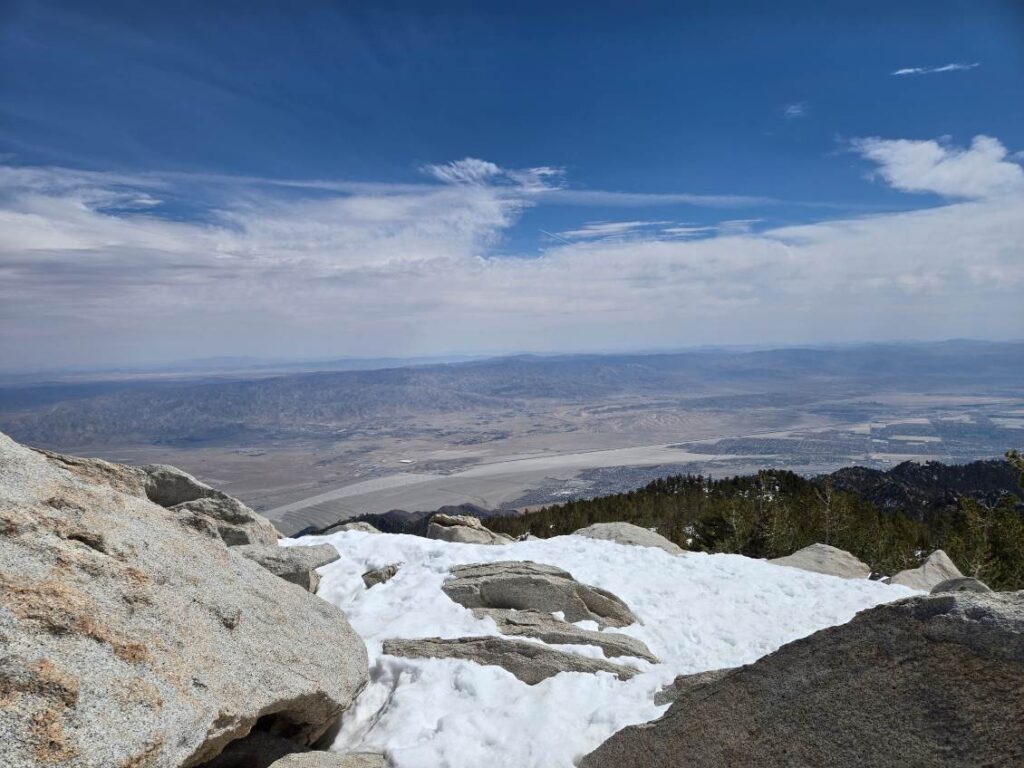
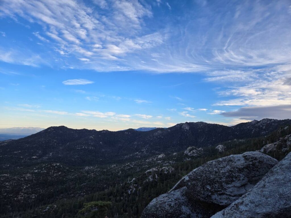
Views from the top of San Jacinto Peak looking northeast towards the Coachella Valley.
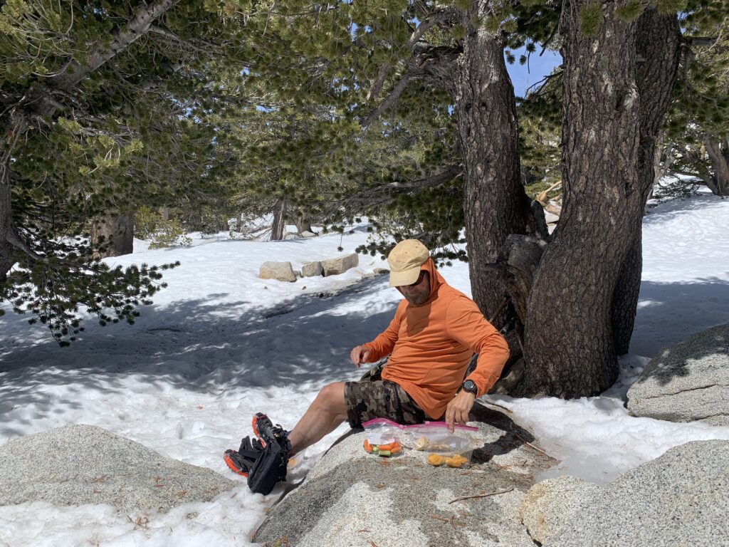
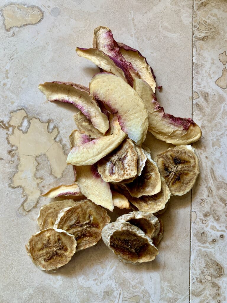
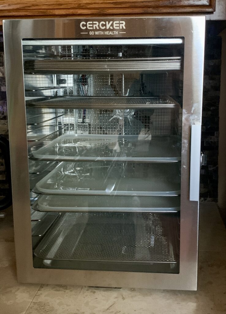
Recently I have been trying to clean up my hiking snacks by bringing healthier alternatives to what I used to bring on day hikes. I still use GU Energy Chews, but am trying to use less and less and focus more on using whole foods as my hiking fuel. My fiance Vance and I recently purchased a Cercker dehydrator and silicone food dehydrator trays which have opened up a wide array of meal and snack opportunities. In preparation for my day hike, Vance dehydrated some white peaches and banana slices. He dusted on some cinnamon and BOOM chips with no added sugar! They were delicious. I am not going to be able to change my eating habits all at once, but little by little I hope to transition to healthier eating on trail. It’s a journey!